Merry Christmas! Last night, with friends, we went to The Chalet on Mt Wellington (1000m above sea level) to have a few drinks, a bbq on the fire and celebrate Christmas. We also knew that we were due to get some snow! As you can see we were not disappointed ... a White Christmas - Tasmania-style!
Monday, December 25, 2006
Saturday, December 23, 2006
HARTZ MOUNTAINS NATIONAL PARK
Today is Andrew's birthday so we decided to take a trek to Hartz Mountains National Park.
Hartz Mountains National Park is a window into the south-west wilderness, offering views of remote mountain ranges as far as the southern coast.
As well as spectacular views of a landscape which has been shaped by glaciers during past ice ages, the park offers a variety of unique features. Waterfalls tumble off the dolerite range that runs through the centre of the park and small glacial lakes dot the plateau. The park contains a wide variety of vegetation from wet eucalypt forest and rainforest through to alpine heath on the exposed mountain tops.
Monday, December 18, 2006
MT FIELD NATIONAL PARK
Took fellow photographers Wendy and Rick up to Mt Field National Park, both to the often-visited lower part but also up the 16km dirt track (thankfully we have a 4WD) to Lake Dobson and did the circuit walk around the lake. There was an abundance of Tasmanian Waratah, which only flowers between November-December, and found between 600-1200m above sea level. It's also much more delicate than the mainland species.
We had a great day!
We had a great day!
SUNRISE - again ...
Saturday, December 09, 2006
MT WELLINGTON SUNRISE
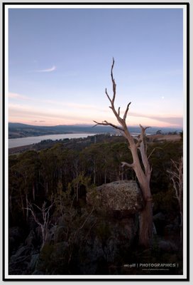
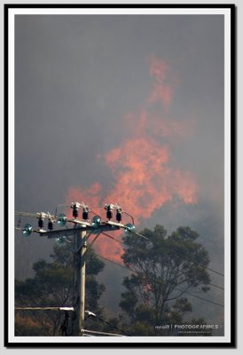
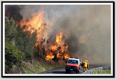
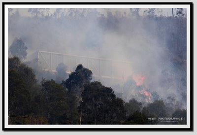
Headed up Mt Wellington this morning for some sunrise shots. There are bushfires burning in parts of Tasmania, and the northerly winds are blowing haze from the Victorian fires our way. Here are the results of ANOTHER early rise..
What do you reckon of the moon? ;)
Rick is an early riser again! (No rest for the wicked, as they say!)
Probably a bit dark, but my point of interest was the sun
Sunday, December 03, 2006
TAROONA - Part 2
I was impressed with the sunrise yesterday at Taroona Beach, so went back again this morning, to what was a much better sunrise in my opinion.
Dragged my mate Rick along as well, it's always much more fun to inflict a 5am shoot on someone else too!
These are a couple of the shots I got today .. enjoy!
Dragged my mate Rick along as well, it's always much more fun to inflict a 5am shoot on someone else too!
These are a couple of the shots I got today .. enjoy!
Saturday, December 02, 2006
TAROONA
Sunrise at Taroona Beach this morning
Taroona (an Aboriginal word meaning sea-shell) is a major residential suburb approximately 15 minutes drive from the centre of Hobart, Tasmania on the scenic route between Hobart and Kingston. Although on the edges of the City of Hobart, Taroona is actually part of the municipality of Kingborough.
The traditional owners of the lands now known as Taroona were the Aboriginal people of the Derwent estuary. Sadly relatively little is known about the indigenous people's use of these lands, although some shell middens are said to have been found along the shorelines.
In February 1967, southern Tasmania was engulfed in the most viscious wildfired on record, resulting in many deaths. Taroona was the closest suburb to the city of Hobart to take the full brunt of the fires, which swept across the suburb in the mid afternoon, wreaking havoc, and destroying many homes. Children and residents fled to the river, and many people's survival was due to the refuge the safe waters provided.
More recently, Taroona was the childhood home of Tasmanian-born Mary, Crown Princess of Denmark, who attended the river-side Taroona High School before completing her High Schooling at Mount Nelson's Hobart College and embarking on her tertiary degree at the University of Tasmania
Tuesday, November 14, 2006
TESSELLATED PAVEMENT
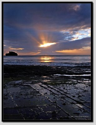
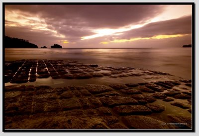
The Tessellated Pavement is an inter-tidal rock platform - a common enough coastal landform. But here an unusual set of geological circumstances have resulted in a rare landform.
The flat-lying siltstone was cracked by stresses in the Earth’s crust, possibly The energy of the waves have significant impact on the coastline (in Scotland waves have been known to exert over 32 tonnes of pressure per square m) and similar stresses may have resulted in features such as the Blowhole on the Peninsula. Hydraulic action is aided by compressed air pushed into cracks and fractures in the rocks. The retreating water results in the expansion of air which can often be an explosive force, heard as a deep thud from above. Abrasion Particles driven by waves also erode coastlines. Sand and pebbles can be thrown against the rocks surfaces with great force.
Similarly the surf acts as a softer yet more repetitive force, dragging fragments back and forth between 160 million years ago and 60 million years ago. The resulting cracks (joints) are seen as three main sets, one aligned to the north- northeast, a second to the east-northeast and the third to the north-northwest. This jointing, exaggerated by processes of erosion, has created the ‘tiled’ appearance. When seawater covers the rock platform, fragments of rock are carried away. Near the seaward edge of the platform, sand is the main cause of the erosion. When combined with wave action the erosional process causes ‘loaf’ or ‘pan’ formations.
Source
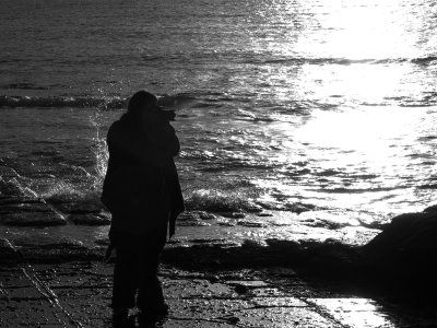
Me at the Tessellated Pavement - I had to get up at 3am to be there for sunrise. Picture taken by Rick Kean (thanks Rick!!)
Saturday, October 28, 2006
OCTOBER SNOW
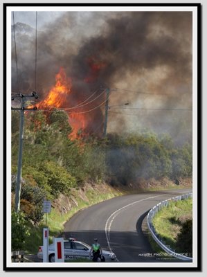
First it was bushfires and 33° days - and last night Hobart saw VERY cold temperatures and low-level snow fall. Andrew and I live 150m above sea level, and our suburb apparently got snow around 10.30pm. We spent the evening with friends who live approximately 350m ASL, and enjoyed a BBQ in the snow (as you do!). Here are some of the pics..
Wednesday, October 25, 2006
TAMAR VALLEY
Thursday, October 19, 2006
SEVEN MILE BEACH
Thought I'd upload this picture I took earlier in the year at Seven Mile Beach. We sometimes go for a little drive (about 15 mins from the city) out there as it was where we lived for a week before settling into our house when we first arrived to live in Tasmania. As you can see even in less-than-perfect weather it's a lovely spot.
P.S Is a heavily edited image - might not float everyone's boat!
Thursday, October 12, 2006
BUSHFIRE - DAY 2
Wednesday, October 11, 2006
Sunday, October 08, 2006
CAN IT SNOW IN SUMMER?
I saw a news report tonight stating that the south-east of Australia is set for heatwave temperatures midweek, so I figured this footage I shot earlier in the year and found today while digging around the hard drives, might 'cool' a few people down!
Please enjoy but remember, I'm a Photographer NOT a Videographer ;)
The picture below is the morning after the video was shot.
Sunday, October 01, 2006
LIFFEY FALLS LODGE B&B - ALPACA STUD FARM
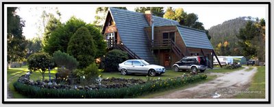
Andrew and I decided a nice weekend away was in order, so after doing a bit of searching on the internet we came across the Liffey Falls Lodge B&B, which is approximately 18km south of Deloraine in the Central Highlands area of Tasmania.
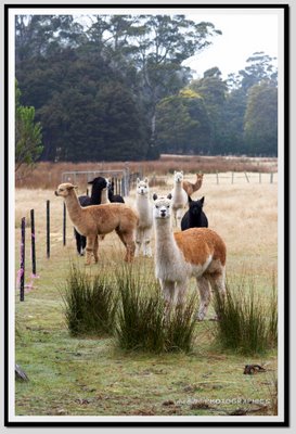
Because of it's proximity to Liffey Falls, the B&B is an absolute treasure! Our hosts Lyn & Paul were absolutely fantastic and provided us with first-class accommodation and the most divine cooked breakfast. The Lodge is set on 60 acres of beautiful land, which incorporates an Alpaca Stud Farm.
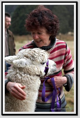
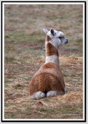
After a lovely warm sleep-in, we awoke to the sound of the fairy-wrens nesting outside our window and the crow of the rooster, and went and fed the Alpacas. These creatures are absolutely gorgeous, and I'm totally hooked on them now.
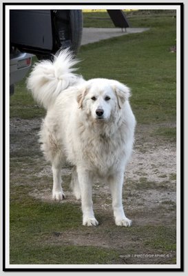
Liffey Falls Lodge B&B is a must-see for animal lovers, including the Alpacas there are 3 other 'permanent' residents (not counting the chickens, ducks & geese); Merlee the affectionate cat, Max the gorgeous Maremma and Wilma the friendly Blue Heeler.
A short drive into Deloraine on Saturday evening at dusk, provided us with the opportunity to spot two dozen Pademelons and about a dozen Possums (yes, we did count!).
We will DEFINATELY be going back to Liffey Falls Lodge B&B, and would highly recommend it to anyone looking to escape the city and get back to nature.
Visit the link: http://www.liffeyfallslodge.com.au (P.S the lodge is for sale also!!)
GREAT WESTERN TIERS
The Great Western Tiers are a collection of small mountain bluffs in the northern part of the Tasmanian Central Highlands.
They stretch from Western Bluff, near the town of Mole Creek, towards the east, passing south of the town of Meander, north of the Great Lake, and ending at Millers Bluff, approximately 25 km west of Campbell Town, near the Macquarie River.
The highest of the peaks is Mount Ironstone, at 1444m.
The lend their name to the Great Western Tiers tourist route, signposted along the Bass Highway
Subscribe to:
Posts (Atom)